Ontario, Canada — The WindEEE Research Institute has confirmed the successful installation of a short-range 3D WindScanner, based on the successful ZephIR Continuous Wave Lidar technology, and supplied by the Wind Energy Department of the Technical University of Denmark (DTU) to study turbulence effects for wind turbines, buildings and structures. The organisations believe it to be the first deployment of its kind, utilising the ‘best in class’ of both 3D wind-system generating wind dome, WindEEE, and a 3D scanning wind lidar measurement sensor, ZephIR / WindScanner.
![]()
Professor Horia Hangan, Director of the WindEEE Research Institute at Western University Canada commented: “Our vision has always been to be a global leader in wind research and innovation, making a global contribution to the resilience of structures. WindEEE, our tornado generating wind dome is now home to the world’s leading measurement system, the WindScanner scanner which is based on equally novel ZephIR Lidar Technology. We very much look forward to communicating the further results from our work as we progress with leading research and educational programs at Western University.”

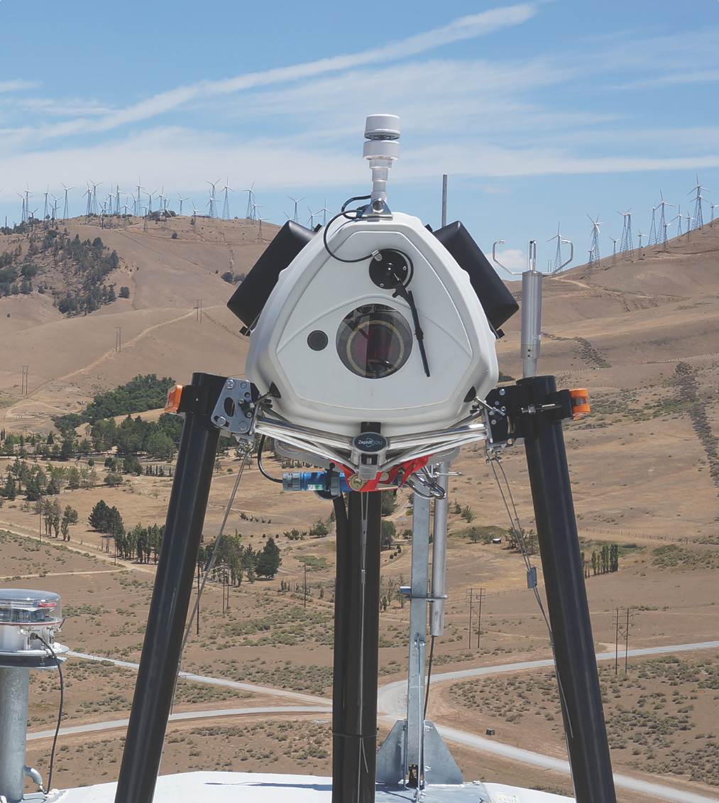
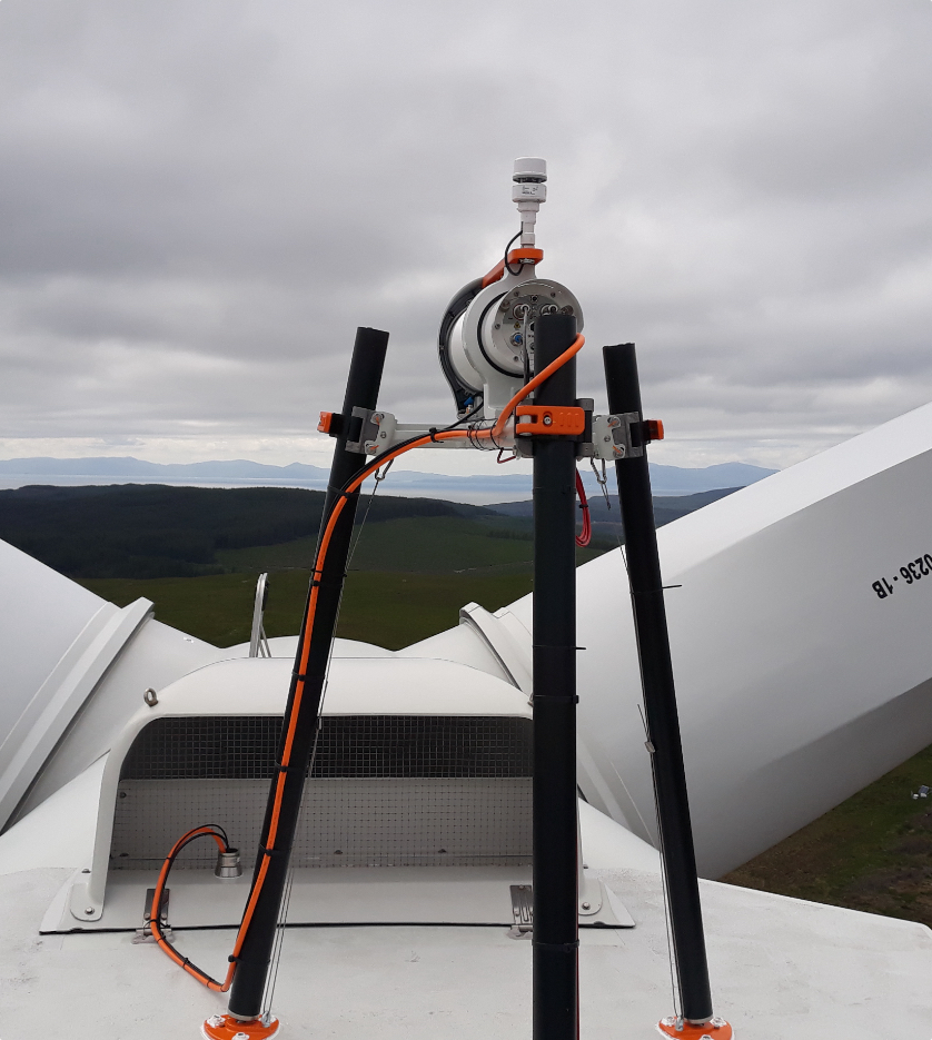
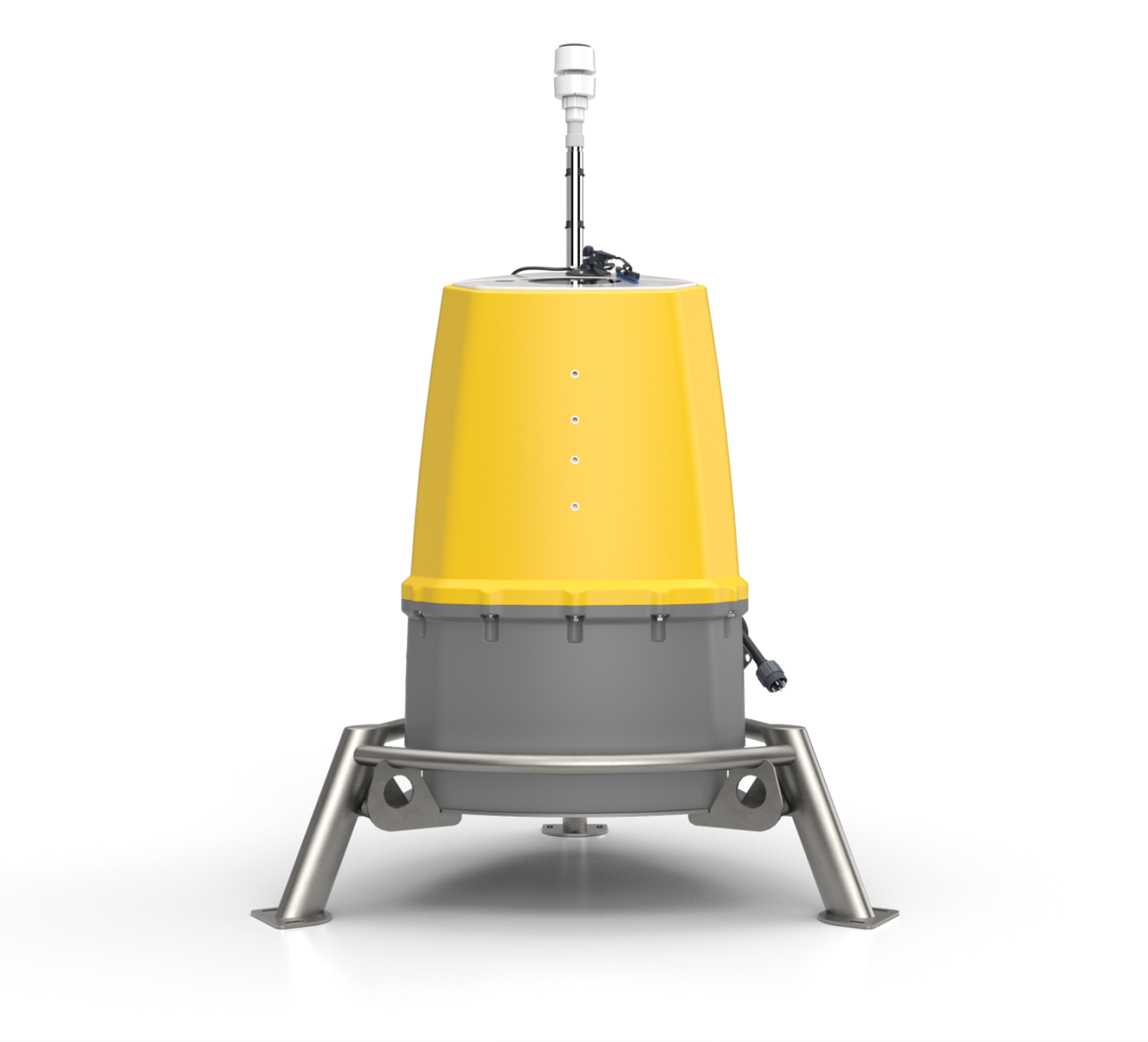
Top Left: WindEEE facility in Ontario, Canada, Top Right: Inside the WindEEE facility where WindScanner is installed, Bottom Left: Flow modelling of the tornado systems that can be generated in WindEEE and measured by WindScanner, Bottom Right: DTU Wind Energy WindScanner with ZephIR Continuous Wave Lidar at core
The Wind Engineering, Energy and Environment (WindEEE) Dome is the world’s first hexagonal wind tunnel. Its large scale structure (25 meters diameter for the inner dome and 40 meters diameter for the outer return dome) allows for wind simulations over extended areas and complex terrain. Uniquely, WindEEE allows for the manipulation of inflow and boundary conditions to reproduce, at large scales and under controlled conditions, the dynamics of real wind systems. By manipulating the outflow and direction of these fans the facility is capable of producing time-dependent, straight, sheared or swirl winds of variable directionality. Therefore a large variety of wind fields such as boundary layers, portions of hurricanes, tornados, downbursts, low level currents or gust fronts can be physically simulated.
WindScanner’s remote sensing wind measurement methodology with integrated syncronized 3-axis beam steering and scanning systems, provide detailed full-scale real atmospheric wind and turbulence measurements. The first of three time and space beam syncronized systems required to measure the variety of the 3D wind conditions generated by WindEEE in the most accurate way possible, with a ZephIR Continuous Wave Lidar at its core, has now been installed.
This combination of state-of-the-art technologies will help the industry understand more about the vulnerability to turbulence of wind turbines, wind farms, and other buildings and structures. With increasing rotor diameters of wind turbines the turbulent effects produced become increasingly significant in the operations, maintenance and performance of modern wind farms.
ZephIR, WindScanner and WindEEE are facing this challenge now head-on and the project has been described as ‘the necessary quantum leap forward in wind research’.
For more information please visit:
ZephIR Continuous Wave Lidar – www.zephirlidar.com
WindScanner 3D Short-Range Scanners – www.windscanner.eu
WindEEE Research Institute – www.eng.uwo.ca/windeee/
Press Desk:
+44 (0) 7825 159 082
Visit www.zephirlidar.com for more information.
© 2014 Zephir Ltd. All rights reserved. ZephIR, Zephir, ZephIR 300, ZephIR DM, ZephIR Care, ZephIR Power and Waltz are trademarks of ZephIR Lidar. Other company and product names may be trademarks of their respective owners.