Get in touch to find out more about our Lidars or services.
Vertical Profiling Lidar offshore
Wind resource assessment and measurements offshore
Responsible for 95%+ of all new offshore wind measurements globally
£150bn of finance invested in clean energy from ZX 300M data
10-300m range - the widest range available of any Lidar
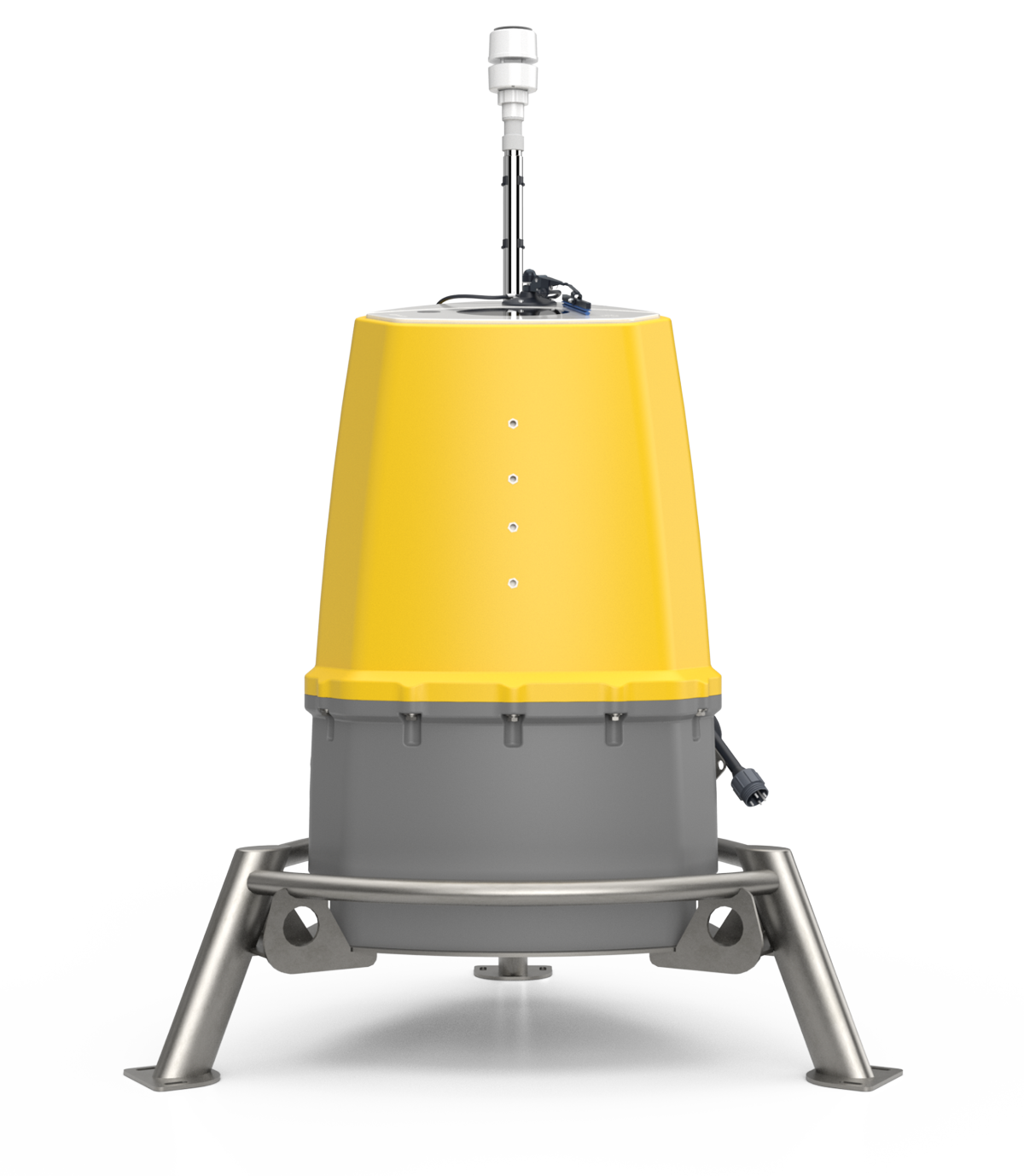
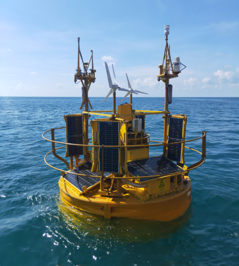
Offshore wind measurements from a vertical profiling Lidar from 10 to 300 meters, fully integrated on all commercially available Floating Lidar Devices. The industry standard offshore, for more than a decade.
We are a ‘Continuous Wave’ Lidar
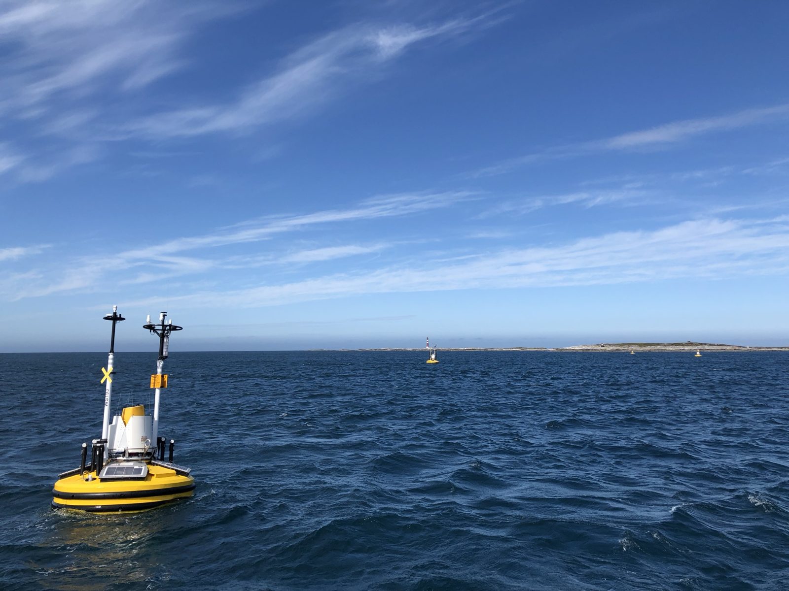
From the ruggedised product casing to the inherent system design of a Continuous Wave Lidar we are very much at home at sea. Our Lidars routinely operate for 3 years autonomously in the harsh offshore environment without missing a beat, or a wave, or a data point.
Quality of data
Quality of data
Records measurements from 10-300m with high data availability at all heights
Made to last
IP69 casing for marine survivability and robustness
Small form factor for met ocean buoys

Our Customer Care Charter defines our best-in-class support and services for our Lidar users. We focus on In-field Support, Validations & Verifications, Warranties and Training
ZX 300M is validated across multiple pre-commercial floating deployments and as mast replacements on fixed platforms.
ZX 300M is available on all major Floating Buoys. Let us introduce you to the OEMs to discuss your individual offshore wind project needs.
Lidar applications
Offshore wind resource assessment
Offshore construction monitoring
Offshore operations & maintenance monitoring
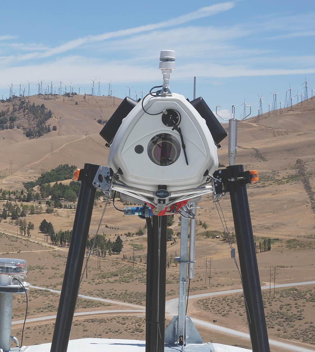
Offshore permanent met Lidar
Offshore helicopter movement planning
Offshore platform design and validation
Wind turbine power performance testing
Range
10 – 300 metres (Lidar measurement)
0 – 10 metres (onboard met weather station)
Probe length
± 0.07 metres @ 10 metres
± 7.70 metres @ 100 metres
Height measured
10 User configurable
1 Additional met weather station measurement
Sampling rate
50Hz (up to 50 measurement points every second)
Averaging rate
True 1-second averaging
10 Minute averaging
Accuracy wind speed
0.1 m/s*
(*as measured against a calibrated moving target)
Direction variation
< 0.5°
Service interval
36 months from new
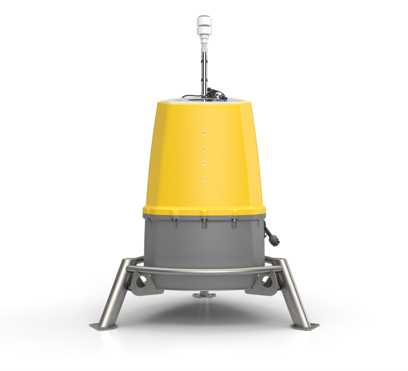
Size
805 x 845 x 966mm
Weight
53.4kg
IP Rating
IP68
Power consumption
45W
Power input
12V
Temperature range
-20 to +50°C
Warranty
3 years
Maintenance
No annual maintenance or calibration in this period
USE CASES
The Use Cases presented here have been tried and tested over the last decade. Lidar users help to inform standards which in turn help to drive change. New Use Cases are being developed all of the time. Benefits are gained throughout a project lifecycle.

Significantly reduce the costs and risks associated with offshore wind resource assessment by using the industry’s choice for floating wind campaigns - ZX 300M.
Deployed on 100% of buoy types commercially available.
Continuous Wave Lidar technology at the heart of ZX 300M is robust against motion-induced errors.
3 year warranty as standard, keeping your through-life costs to a minimum with no need to service or calibrate during this period - no other Lidar comes close.
Collecting wind data offshore can be prohibitively expensive with tall mast structures.
Floating Lidar has been used to collect data for the purpose of financing offshore wind farms.

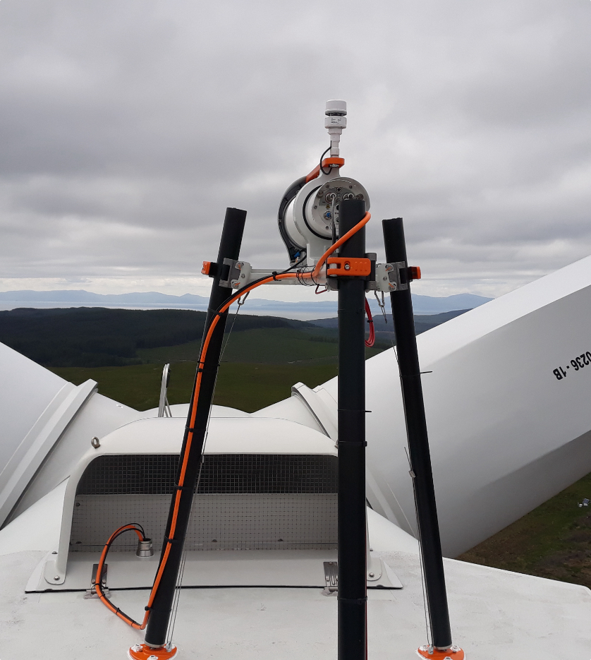
Support an offshore met mast during maintenance or in replacement should the mast need removing.
ZX 300M provides low 10m measurements through to tip height and above, and can be SCADA / grid integrated providing a new standard in operational wind measurements.
Remove the need to work at height actively working towards industry Health & Safety best practice.
Measurements from 10m to 200m provide correlations to existing anemometry at all heights.
More accurately apply curtailment strategies / wind sector management.
Undertake measurements in the case of either turbine / turbine component or power loss on site in support of any insurance claims.
Improve the accuracy of the forecasting model may be used for energy trading, access / egress or planned maintenance forecasting used to reduce Waiting on Weather downtime.
With 1-second Quality Controlled data, a live feed from a permanently installed Lidar may be used to inform transport movements, for example helicopter lifts and craning.
With an almost real-time, accurate shear profile, any airborne movements around site can be conducted more efficiently and allow operators to work with a higher level of certainty within their internally approved safety windows for these operations.

UK Civil Aviation Authority’s CAP 437 requires offshore helidecks to provide accurate, rotor downwash-free wind measurements to ensure safe helicopter operations. Non-compliance can result in restricted usage, reducing operational windows.

Traditional platform-based anemometry systems can be impacted with interference from platform structures. This impacts the wind data being monitored and restrictions on safe operations of the platform may be introduced in order to comply.
The ZX 300M wind Lidar delivers free-stream wind measurements above platform structures reducing or removing entirely the impact from any structures nearby. Compact and easily installed, ZX 300M provides precise, real-time wind speed and direction data without the need for elevated sensors or rope access. Benefits of a Helideck-integrated wind Lidar include:
CAP 437 Compliance: Unrestricted, safe helideck operations.
Efficiency: Extended operational windows and reduced costs from flight turnarounds due to changing conditions on the platform.
Versatility: Supports weather forecasting, structural monitoring, and wind data collection for any additional wind project development near the platform.
Extreme events can also be monitored and any results fed in to the design of new platforms.

Determine the wind conditions on site to inform accurate decision making during wind farm construction, acceptance, operations and maintenance. Lidar improves the accuracy of planning access / egress or planned maintenance, and can be used to reduce Waiting on Weather downtime.
ZX 300M provides wind speed and direction measurements up to crane heights and above.
With 1-second Quality Controlled data, a live feed from a permanently-installed Lidar may be used to inform transport movements, for example helicopter lifts and craning around site.
With an almost real-time, accurate shear profile, any airborne movements around site can be conducted more efficiently and allow operators to work with a higher level of certainty within their internally approved safety windows for these operations.


<1
PERFECT FOR:
Small scale projects
Temporary events
1-2
PERFECT FOR:
Small scale projects
Temporary events
3+
PERFECT FOR:
Long term projects
Operational measurements
5


Validate your wind turbine performance and reach financial close with nacelle based Lidar Power Performance Testing. Optimise asset performance with operational power curve and yaw measurements. Develop wind farm Lidar control strategies with wake steering and load control.
Power Performance Measurements and Testing to IEC standards including IEC 61400-50-3:2022
Accepted by all major turbine OEMs
Unique measurements of wakes and complex flow
True wind shear and wind veer measurements across the whole rotor
Reduce your offshore wind farm project and financial uncertainty by measuring wind characteristics higher than a met mast and by mobilising measurements across a whole site with wind Lidar. Integrated in to all major Floating Buoy platforms.
Wind resource assessment and measurements offshore
Responsible for 95%+ of all new offshore wind measurements globally
£150bn of finance invested in clean energy from ZX 300M data
10-300m range - the widest range available of any Lidar

An evolution of the world’s most validated onshore, finance-grade, IEC-compliant, vertical-profiling wind Lidar for onshore wind development and operational projects.
Industry-leading 21-200m IEC Classification
Enhanced accuracy and availability up to 300m
Cup-Equivalent Turbulence Intensity measurements
Ultra-low power down to -25°C
It looks like we need more information to be able to help you.
If you click on the button below and leave your information, one of our support team will get in touch to help you find the right product.


